Browse Resources
Resources |
|---|
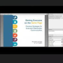 This webinar recording, provided by EvaluATE: Evaluation Resource Center for Advanced Technological Education, discusses strategies for evaluator-stakeholder communication. Throughout the webinar, presenters cover "innovative and practical strategies to improve communication between those involved...
 The ATETV project delivers web-based videos to connect students to careers in advanced technology. This episode of ATETV looks at careers at Microsoft. A software developer and a software engineer at Microsoft talk about their work. Listening to these professionals describe what they do will help...
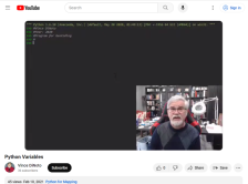
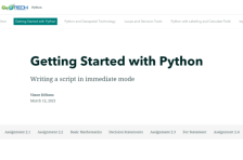 This resource, provided by the GeoTech Center, is the second of nine online modules in the Python and Geospatial Mapping course. The course is designed for experienced users of Global Information Systems (GIS) platforms who are new to programming, with the goal of teaching them how to use Python to...
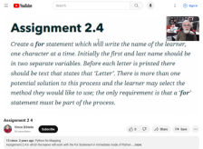
 This video assignment, provided by the GeoTech Center, is from module two of the Python and Geospatial Mapping course, titled Getting Started. The course is designed for experienced users of Global Information Systems (GIS) platforms who are new to programming, with the goal of teaching them how to...
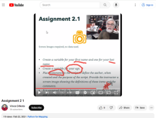
 This video assignment, provided by the GeoTech Center, is the second assignment from module two of the Python and Geospatial Mapping course, titled Getting Started. The course is designed for experienced users of Global Information Systems (GIS) platforms who are new to programming, with the goal of...
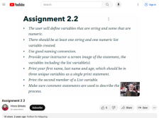
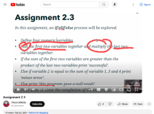 This video assignment, provided by the GeoTech Center, is the third assignment from module two of the Python and Geospatial Mapping course, titled Getting Started. The course is designed for experienced users of Global Information Systems (GIS) platforms who are new to programming, with the goal of...
 This video assignment, provided by the GeoTech Center, is the third assignment from module two of the Python and Geospatial Mapping course, titled Getting Started. The course is designed for experienced users of Global Information Systems (GIS) platforms who are new to programming, with the goal of...
 This video, provided by the GeoTech Center, is from the second module of the Python and Geospatial Mapping course. The course is designed for experienced users of Global Information Systems (GIS) platforms who are new to programming, with the goal of teaching them how to use Python to automate...
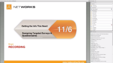 This webinar, made available by Maricopa Advanced Technology Education Center (MATEC), discusses how instructors can maximize the usefulness of student survey data by designing quality student surveys. The webinar was presented by Dr. Catherine Nameth, Education Coordinator at UCLA. Topics covered...
 This presentation, provided by the National Convergence Technology Center (CTC), was delivered to give members of the Convergence College Network (CCN) community of practice a quick overview of the benefits of CCN membership. This video was developed in response to a request from a new CCN member,...
|
| ← PreviousNext → |