Browse Resources
Resources |
|---|
The Illinois GIS Association was created to unite the geographic information system (GIS) community together in order to work together to overcome the challenges of the field. This association allows businesses and individuals in GIS to share their experiences and expertise, to participate in...
This video, created by Integrated Geospatial Education and Technology Training Project (iGETT), is the second part of a two part series on monitoring vegetation greeness with remote sensing. This video is a mini quiz that includes seven questions and answers. Questions include the following: What is...
This video, from the Integrated Geospatial Education and Technology Training Project (iGETT), is the first part of a two-part presentation on monitoring vegetation greenness with remote sensing. The lecture focuses on use of the the Normalized Difference Vegetative Index (NDVI), including data...
This video, provided by Virginia Geospatial Extension, is part of a series of 28 tutorial videos on remote sensing with ArcGIS Pro. This tutorial "uses ArcGIS Pro version 2.3 to discuss imagery and data stored by the USGS." This video runs 03:23 minutes in length. The other videos in the series are...
This video, created by Integrated Geospatial Education and Technology Training Project (iGETT), discusses the four types of resolutions important when acquiring or using remote sensing imagery. The four types of resolutions include: spatial, spectral, radiometric, and temporal. Each resolution is...
Learning Unit Description:
The Integrated Geospatial Education and Technology Training Project (iGETT) presents a series of Learning Units (LU) designed to incorporate federal land remote sensing data into Geographic Information System (GIS) instruction. The A Beginning Assessment Comparing...
This video, provided by Virginia Geospatial Extension, is part of a series of 28 tutorial videos on remote sensing with ArcGIS Pro. This tutorial "uses ArcGIS Pro version 2.3 to illustrate how to interpret metadata that accompanies a Landsat scene" This video runs 07:32 minutes in length. The other...
This tutorial, provided by Virginia Geospatial Extension, is part of a series of 30 videos that cover remotely sensed data in ArcMap 10.x versions. This video covers accessing and viewing metadata. This video runs 01:32 minutes in length. The other videos in the series are available to view...
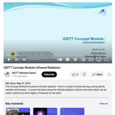
This video, created by Integrated Geospatial Education and Technology Training Project (iGETT), covers how infrared radiation is used in remote sensing and by plants, animals, and humans. The video covers "the band values for infrared radiation and how the information can be used in astronomy and...
This resource, provided by the GeoTech Center, is the sixth of nine online modules in the Python and Geospatial Mapping course. The course is designed for experienced users of Global Information Systems (GIS) platforms who are new to programming, with the goal of teaching them how to use Python to...
|
| ← PreviousNext → |
