Browse Resources
Resources |
|---|
 This video, created by Integrated Geospatial Education and Technology Training Project (iGETT), discusses techniques for object recognition on aerial imagery using examples from forestry. The video includes the following sections: Introduction to Object Recognition, Object Recognition Elements,...
 GeoTech Center presents this course on Open Source software for desktop and online GIS applications. The course introduces "the concepts of Open Source software, and the leading desktop and web mapping Open Source software packages." A syllabus includes recommended textbooks, a schedule, and student...
 This video, provided by Virginia Geospatial Extension, is part of a series of 30 videos that cover remotely sensed data in ArcMap 10.x versions. This video shows how to open an existing map or create a new one in ArcMap. This video runs 00:45 seconds in length. The other videos in the series are...
 This tutorial, provided by Virginia Geospatial Extension, is part of a series of 30 videos that cover remotely sensed data in ArcMap 10.x versions. Tutorial seven is divided into four videos: A, B, C, and D. This video shows how to order data in GLOVIS. The video runs 01:08 minutes in length. The...
 This video, from the Integrated Geospatial Education and Technology Training Project (iGETT), uses a paint-by-number analogy to explain supervised classification in GIS data. The demonstration addresses some of the pros and cons of the process, and quiz questions are included at the end to test...
 This page showcases student projects and other resources that may be used for GIS education. Users may view the resources as a grid, or by selecting the list view, they may read a brief description of each resource. These learning activities and interactive tools cover topics such as sociology,...
 The Pennsylvania State University offers B.S., B.A., M.S., and Ph.D. degrees in Geography. The faculty encourage students to arrange courses of study appropriate to their individual needs and aspirations. Programs in geography may be directed toward a career in public service, teaching and research,...
 This curriculum resource, created by Penn State University for the Youth Engaged in Technology program (YET) is geared toward 4-H participants interested in learning about GIS technologies. This four week course module covers the fundamentals of GIS mapping as well as how to read and use GIS maps....
 This video, created by Integrated Geospatial Education and Technology Training Project (iGETT), provides an introduction to photogrammetry and aerial imagery concepts. Useful calculations using photogrammetry principles are also discussed. An outline of topics is provided and includes the following...
 Learning Unit Description:
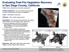
The Integrated Geospatial Education and Technology Training Project (iGETT) presents a series of Learning Units (LU) designed to incorporate federal land remote sensing data into Geographic Information Systems (GIS) instruction. The Evaluating Post-Fire Vegetation...
|
| ← PreviousNext → |