Browse Resources
Resources |
|---|
 Learning Unit Description:
The Integrated Geospatial Education and Technology Training Project (iGETT) presents a series of Learning Units (LU) designed to incorporate federal land remote sensing data into Geographic Information System (GIS) instruction. The Tracking Land Cover Changes in the San...
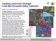
 This exercise, from the Integrated Geospatial Education and Technology Training Project (iGETT), uses remote sensing data to identify land cover changes in the San Fernando Valley of Southern California using Landsat ETM+ imagery. The four part activity uses ArcGIS 10.1 and covers file management,...
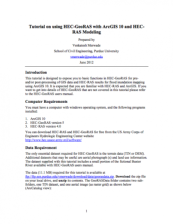 This tutorial, from Purdue University, "is designed to expose users to basic functions in HEC-GeoRAS for pre- and/or post-processing of GIS data and HEC-RAS results for flood inundation mapping using ArcGIS." After outlining computer and data requirements, the tutorial outlines "Setting up Analysis...
 Tutorial Description:
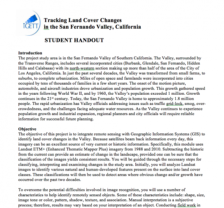
This exercise, created by the Integrated Geospatial Education and Technology Training Project (iGETT), serves as a tutorial for advanced Geographic Information System (GIS) students within the framework of a remote sensing class or raster GIS class with a strong remote...
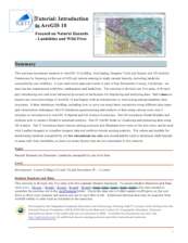 Tutorial Description:
This exercise, created by the Integrated Geospatial Education and Technology Training Project (iGETT), serves as a tutorial for introductory Geographic Information Systems (GIS), using real-world environmental data on natural hazards from San Bernardino County, California,...
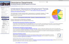 This page from the SAGE 2YC project provides a list of links to articles, webinars, data and other information on recent geoscience employment trends which will be very useful for GIS faculty and students. The page is divided into several sections: Future Geoscience Workforce Needs, Resources and...
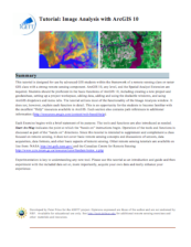
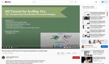 This tutorial, provided by Virginia Geospatial Extension, is part of a series of 30 videos that cover remotely sensed data in ArcMap 10.x versions. This tutorial is divided into two videos (18A and 18B) and covers "unsupervised classification of Landsat Imagery." During the tutorial, unsupervised...
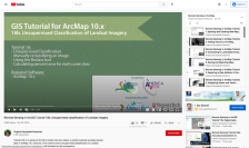 This tutorial, provided by Virginia Geospatial Extension, is part of a series of 30 videos that cover remotely sensed data in ArcMap 10.x versions. This tutorial is divided into two videos (18A and 18B) and covers "unsupervised classification of Landsat Imagery." During the tutorial, unsupervised...
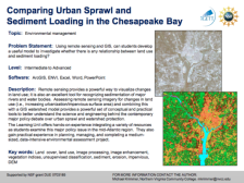 Exercise Description:
This exercise, created by the Integrated Geospatial Education and Technology Training Project (iGETT) asks students to develop a model to examine the relationship between land use and sediment loading. Data from the Chesapeake Bay region will be utilized. Remote sensing...
 The Urban and Regional Information Systems Association (URISA) “is a multidisciplinary association where professionals from all parts of the spatial data community can come together and share concerns and ideas.” URISA connects the GIS community through webinars, workshops, publications, a career...
|
| ← PreviousNext → |