Browse Resources
Resources |
|---|
 This video, provided by Virginia Geospatial Extension, is part of a series of 28 tutorial videos on remote sensing with ArcGIS Pro. This tutorial "uses ArcGIS Pro version 2.2 to illustrate how to display vector data in ArcGIS Pro." This video runs 10:34 minutes in length. The other videos in the...
 This website from the Minnesota department of natural resources provides information on the Garmin DNR application. The purpose of the application, its functionality and screenshots are included. The site also includes links which may be used to download the program.
 This video, provided by Virginia Geospatial Extension, is part of a series of 28 tutorial videos on remote sensing with ArcGIS Pro. This tutorial "provide[s] step by step instructions for downloading Landsat 8 imagery via USGS's EarthExplorer website." This video runs 10:45 minutes in length. The...
 This tutorial, provided by Virginia Geospatial Extension, is part of a series of 30 videos that cover remotely sensed data in ArcMap 10.x versions. This video demonstrates viewing and downloading Landsat imagery using Earth Explorer. The video runs 01:55 minutes in length. The other videos in the...
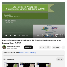 This tutorial, provided by Virginia Geospatial Extension, is part of a series of 30 videos that cover remotely sensed data in ArcMap 10.x versions. Tutorial seven is divided into four videos: A, B, C, and D. This video demonstrates using the GLOVIS viewer. This video runs 02:32 minutes in length....
 This two-part exercise, created by Jeannie Allen and offered by the Integrated Geospatial Education and Technology Training Project (iGETT), introduces students to the process of locating and downloaded Landsat data from the United States Geological Survey (USGS) GloVIS website (part one), and how...
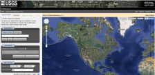 This tool from the United States Geological Survey provides an easy way to navigate a variety of data sets including aerial photography, AVHRR composites, declassified data, digital line graphs, digital maps and more. The tool also makes it easy to find the latitude and longitude for a given...
 ArcGIS Online provides ArcGIS users with a set of foundation services that are deeply integrated with ArcGIS. As an ArcGIS user, you have immediate access to map services, task services, software developer kits (SDKs), and other content via the Web. ArcGIS Online services are available as standard,...
 The Environmental Systems Research Institute (ESRI) presents GeoInquiries, a database of educational resources on GIS technology and other general education topics. "Lessons include learning objectives, technical "how-to's", textbook references, and formative whole-class assessment items - all...
 This video is provided by GeoTech and is part of a series on web mapping. During this video, the presenter discusses Esri Insights by showcasing a simple Insights page on wineries. Esri Insights is a data analytics and visualization tool that allows users to create dynamic maps, charts, and...
|
| ← PreviousNext → |