Browse Resources
Information and Security Technologies -- Geospatial technologies
Resources |
|---|
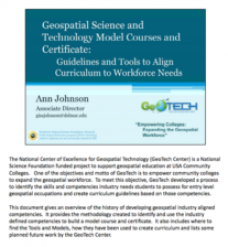 This thirty-seven page document discuses model courses for a model certificate developed by GeoTech. Slides from a past presentation are included along with annotations. Five core courses are recommended including Introduction to Geospatial Technology, Spatial Analysis and Modeling, and Data...
 The GeoTech Center curated this list of geospatial technology resources for the benefit of both students and instructors in this subject area. The resources include: "How To Incorporate American Community Survey data from TIGER Files," "Going Places With GPS," "GPS Units by GIS Etc.," and "GPS...
 The GeoTech Center curated this list of textbook resources for the benefit of both students and instructors in this subject area. Included in this list is a variety of textbooks related to geospatial subjects, including: introductory materials, ArcGIS, GIS, GPS, and the python programming language.
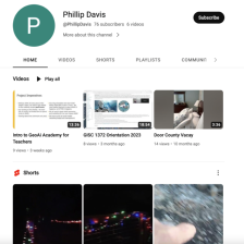 The GeoTech Center, from Del Mar College, presents their YouTube channel, featuring videos on geospatial technology education, competitions, workforce, and more. View a number of the GeoTech Center's webinars, on topics from integrating GIS across the curriculum to developing e-portfolios.
 This page from the GeoTech Center provides links to several websites with information on geospatial careers. These include the Geospatial Job and Career Center at Directions Magazine, the career section of ESRI's website for those interested in working for this GIS software company, the GIS Lounge's...
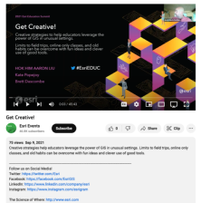 This video, from the 2021 Esri Education Summit, provides three presentations on "creative strategies to help educators leverage the power of GIS in unusual settings." In the first presentation, Hok Him "Aaron" Liu provides information on the use of GIS and StoryMap for K-12 geography education in...
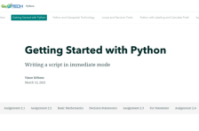 This resource, provided by the GeoTech Center, is the second of nine online modules in the Python and Geospatial Mapping course. The course is designed for experienced users of Global Information Systems (GIS) platforms who are new to programming, with the goal of teaching them how to use Python to...
 This video assignment, provided by the GeoTech Center, is from module two of the Python and Geospatial Mapping course, titled Getting Started. The course is designed for experienced users of Global Information Systems (GIS) platforms who are new to programming, with the goal of teaching them how to...
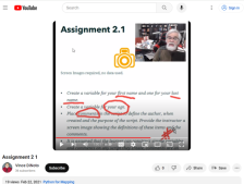
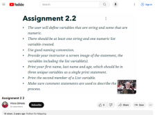 This video assignment, provided by the GeoTech Center, is the second assignment from module two of the Python and Geospatial Mapping course, titled Getting Started. The course is designed for experienced users of Global Information Systems (GIS) platforms who are new to programming, with the goal of...
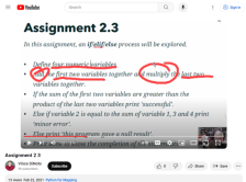 This video assignment, provided by the GeoTech Center, is the third assignment from module two of the Python and Geospatial Mapping course, titled Getting Started. The course is designed for experienced users of Global Information Systems (GIS) platforms who are new to programming, with the goal of...
|
| ← PreviousNext → |