Browse Resources
Information and Security Technologies -- Geospatial technologies
Resources |
|---|
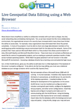 This two page document from GeoTech describes how to use a web browser for geospatial data editing. The ArcGIS Server software from Esri provides this technology. For live map editing, a relational database, such as the free SQL Express, must be used as the "storage container." A diagram illustrates...
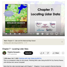 This video, provided by Virginia Geospatial Extension, is part of a series of 22 tutorial videos on working with Lidar using ArcGIS Pro. This tutorial demonstrates how to locate available lidar data. This video runs 8:34 minutes in length. The other videos in the series are available to view...
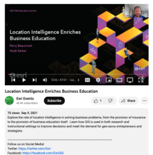 This video, from the 2021 Esri Education Summit, provides two presentations that explore the role of location intelligence in solving business problems. Viewers learn how GIS is used in both research and instructional settings to improve decisions and meet the demand for entrepreneurs and...
 This resource, provided by the GeoTech Center, is the fourth of nine online modules in the Python and Geospatial Mapping course. The course is designed for experienced users of Global Information Systems (GIS) platforms who are new to programming, with the goal of teaching them how to use Python to...
 This video assignment, provided by the GeoTech Center, is the first assignment from module four of the Python and Geospatial Mapping course, Loops and Decision Tools. The course is designed for experienced users of Global Information Systems (GIS) platforms who are new to programming, with the goal...
 This video assignment, provided by the GeoTech Center, is the second assignment from module four of the Python and Geospatial Mapping course, Loops and Decision Tools. The course is designed for experienced users of Global Information Systems (GIS) platforms who are new to programming, with the goal...
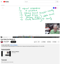 This video case study assignment, provided by the GeoTech Center, is from module four of the Python and Geospatial Mapping course, titled Loops and Decision Tools. The course is designed for experienced users of Global Information Systems (GIS) platforms who are new to programming, with the goal of...
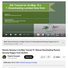 This tutorial, provided by Virginia Geospatial Extension, is part of a series of 30 videos that cover remotely sensed data in ArcMap 10.x versions. Tutorial seven is divided into four videos: A, B, C, and D. This video covers manually downloading data from GLOVIS. This video runs 00:47 seconds in...
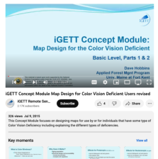 This video, created by Integrated Geospatial Education and Technology Training Project (iGETT), discusses designing maps for individuals who have some type of color vision deficiency. The video covers the following topics: what is color blindness, causes, classification, what does it matter, effects...
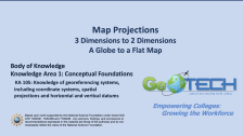 This module is provided by GeoTech Center, and introduces concepts that are related to map projections. Module contents include a video recording, a PowerPoint presentation, and a quiz that reviews the content presented in the module.
The Concept Module is a recorded PowerPoint presentation...
|
| ← PreviousNext → |