Browse Resources
Information and Security Technologies -- Geospatial technologies
Resources |
|---|
 This video workshop, from the 2021 Esri Education Summit, teaches participants about finding and using demographic data for more than 130 countries. In the video, Joseph Kerski outlines the demographic and socio-economic variables that are available through the ArcGIS Living Atlas of the World,...
 This video, created by Integrated Geospatial Education and Technology Training Project (iGETT), provides an introduction to photogrammetry and aerial imagery concepts. Useful calculations using photogrammetry principles are also discussed. An outline of topics is provided and includes the following...
 Published in the American Educator, this is a resource paper on the impact of spatial thinking and literacy on American K-12 education. It includes four spatial thinking tests which were used in the project talent study discussed in the article.
 Learning Unit Description:
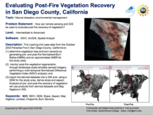
The Integrated Geospatial Education and Technology Training Project (iGETT) presents a series of Learning Units (LU) designed to incorporate federal land remote sensing data into Geographic Information Systems (GIS) instruction. The Evaluating Post-Fire Vegetation...
 Learning Unit Description:
The Integrated Geospatial Education and Technology Training (iGETT) presents a series of Learning Units (LU) designed to incorporate federal land remote sensing data into Geographic Information Systems (GIS) instruction. This lesson uses GIS and remote sensing...
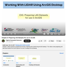 This video, provided by Virginia Geospatial Extension, is part of a series of 16 tutorial videos on using Lidar with ArcGIS Desktop. This tutorial demonstrates how to prepare LAS-formatted Lidar datasets for use in ArcGIS Desktop. This video runs 05:21 minutes in length. The other videos in the...
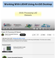 This video, provided by Virginia Geospatial Extension, is part of a series of 16 tutorial videos on using Lidar with ArcGIS Desktop. This tutorial demonstrates how to process LAZ-formatted datasets from the United States Geological Survey (USGS) using Earth Explorer. This video runs 1:53 minutes in...
 Collection Description:
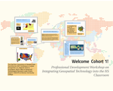
This collection from the GeoTech Consortium of Western New York (GTCWNY) features material related to the Professional Development Workshop on Integrating Geospatial Technology into the High School Classroom hosted by GTCWNY. There were two cohorts of the workshop and a...
 These presentation slides, provided by the GeoTech Consortium of Western New York (GTCWNY), are from the Professional Development Workshop on Integrating Geospatial Technology into the HS Classroom hosted by GTCWNY. The workshop focused on Geographic Information Systems (GIS) education and ways to...
 In this video, provided by SEC Studios, Carl Johnson goes through the proper AutoTrac set up on the GreenStar 3 2630 Display. Starting on his home screen, Johnson goes through each step of the process. This video runs 02:57 minutes in length.
|
| ← PreviousNext → |