Browse Resources
Information and Security Technologies -- Geospatial technologies
Resources |
|---|
 This video features Colonel David Buckman, from Air Force Space Command, discussing GPS and how it works. GPS is provided free of charge by the United States Air Force, made possible by satellites orbiting the earth that broadcast radio signals, and provides highly accurate time to enable critical...
 This video, from the Integrated Geospatial Education and Technology Training Project (iGETT), is the first part of a two-part presentation on thermal infrared sensing. Topics covered include an introduction to the concept of thermal infrared, thermal radiation laws (including Backbody,...
 This video, from the Integrated Geospatial Education and Technology Training Project (iGETT), is the second part of a two-part presentation on thermal infrared sensing. It begins with an opportunity to address questions from the first part of the presentation and then reviews concepts with multiple...
 This webpage from the GeoTech Center features a document from Irina Kopteva of Pikes Peak Community College discussing the Tiered Internship Model for students in geospatial technology. The goal of the project was "to create a tiered internship program with industry that will start with two-year...
 Learning Unit Description:
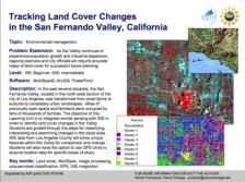
The Integrated Geospatial Education and Technology Training Project (iGETT) presents a series of Learning Units (LU) designed to incorporate federal land remote sensing data into Geographic Information System (GIS) instruction. The Tracking Land Cover Changes in the San...
 This exercise, from the Integrated Geospatial Education and Technology Training Project (iGETT), uses remote sensing data to identify land cover changes in the San Fernando Valley of Southern California using Landsat ETM+ imagery. The four part activity uses ArcGIS 10.1 and covers file management,...
 This tutorial, from Purdue University, "is designed to expose users to basic functions in HEC-GeoRAS for pre- and/or post-processing of GIS data and HEC-RAS results for flood inundation mapping using ArcGIS." After outlining computer and data requirements, the tutorial outlines "Setting up Analysis...
 Tutorial Description:
This exercise, created by the Integrated Geospatial Education and Technology Training Project (iGETT), serves as a tutorial for advanced Geographic Information System (GIS) students within the framework of a remote sensing class or raster GIS class with a strong remote...
 Tutorial Description:
This exercise, created by the Integrated Geospatial Education and Technology Training Project (iGETT), serves as a tutorial for introductory Geographic Information Systems (GIS), using real-world environmental data on natural hazards from San Bernardino County, California,...
 This web page provides an overview of a research study on the National Geospatial Technology Center of Excellence (GeoTech Center) Unmanned Aircraft Systems (UAS) MetaDACUM. The study's purpose was to "... explore the viewpoints of UAS practitioners towards GeoTech's MetaDACUM." By evaluating these...
|
| ← PreviousNext → |