Browse Resources
Information and Security Technologies -- Geospatial technologies
Resources |
|---|
 This DACUM, a curriculum development resource based on occupational analysis, is targeted specifically for Remote Sensing Specialists and was developed at a panel presentation in Denver, Colorado. General knowledge, skills, worker behaviors, tools, future trends, and acronyms are listed on this...
 This DACUM, a curriculum development resource based on occupational analysis, is targeted specifically for Remote Sensing Specialists and was developed at a panel presentation in California in August 2009. On the first page, all of the duties with their corresponding tasks are listed, with entry...
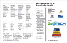
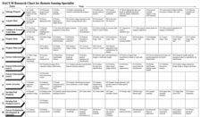
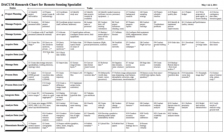 This DACUM, a curriculum development resource based on occupational analysis, is targeted specifically for Remote Sensing Specialists and was developed at a panel presentation in Wisconsin in May 2011. On the first page, all of the duties with their corresponding tasks are listed, with entry level...
 Description:
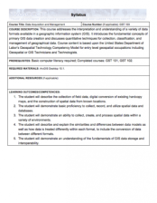
This Data Acquisition and Management course, from the National Information, Security & Geospatial Technologies Consortium, is part of a series of model courses on GIS, spatial technologies, and related subjects to provide students with the professional skills necessary to succeed in...
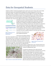 Students enrolled in introductory geospatial classes need to have access to data, which can be simply located and requires only fundamental knowledge of the software being used for the first few lessons/case studies. Jefferson Community and Technical College (JCTC) has data available in four...
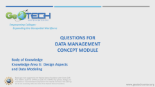 This module is provided by GeoTech Center, and introduces data management concepts that are related to data management systems for geospatial technologies. Module contents include a video recording, two different versions of the PowerPoint presentation featured in the video, and a quiz that reviews...
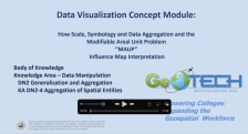 This module is provided by GeoTech Center, and discusses concepts related to data visualization and geospatial technologies. Module contents include a video recording, the PowerPoint presentation featured in the video, and a module overview document.
The Concept Module is a recorded PowerPoint...
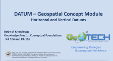 This module is provided by GeoTech Center, and introduces the horizontal and vertical datums. This learning module stresses the importance of datums in geographic information systems. Module contents include a video recording, a PowerPoint file of the slides from the presentation, a folder of past...
 This video from the National Center for Autonomous Technologies is a recording of the December 2022 Connected By Drones meeting. In the video, community based organizations (CBOs) are described, the difference between federally recognized identification areas (FRIAs) and fixed sites are highlighted,...
 Learning Unit Description:
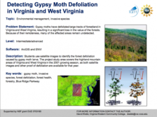
The Integrated Geospatial Education and Technology Training Project (iGETT) presents a series of Learning Units (LU) designed to incorporate federal land remote sensing data into Geographic Information Systems (GIS) instruction. The Detecting Gypsy Moth Defoliation in...
|
| ← PreviousNext → |