Browse Resources
Audio/Visual -- Movie/Animation
Resources |
|---|
 This website includes a Java applet that displays the effect that various operations on an N-periodic, discrete-time signal (e.g. time shift, time scale, filtering) have on the signal and its spectra. Sketch the signal or magnitude and phase spectra with the mouse, and then select the operation.
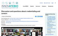 This video, published by InnovATEBIO, provides a discussion between educators on credentialing and biotechnology education. Topics explored include the Biotechnician Assistant Credentialing Exam (BACE), Covid-19, biotechnology programs, and more. The video recording runs 18:41 minutes in length.
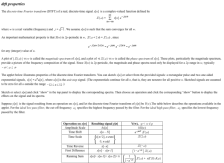
 This interactive presentation, created by James Bourassa and John Rosz for the Electromechanical Digital Library, discusses displacement and velocity ratios. Bourassa and Rosz begin by providing detailed definitions of both topics and then provide mathematical examples of each. Once this basic...
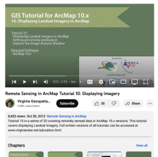 This tutorial, provided by Virginia Geospatial Extension, is part of a series of 30 videos that cover remotely sensed data in ArcMap 10.x versions. This video covers displaying Landsat imagery in ArcMap, Setting processing workplaces, and the Image Analysis Window. This video runs 02:53 minutes in...
 This video, provided by Virginia Geospatial Extension, is part of a series of 28 tutorial videos on remote sensing with ArcGIS Pro. This tutorial "uses ArcGIS Pro version 2.3 to illustrate how to display different bands of a Landsat scene..." The band's properties are examined, including viewing and...
 This tutorial, provided by Virginia Geospatial Extension, is part of a series of 30 videos that cover remotely sensed data in ArcMap 10.x versions. This video demonstrates modifying symbology for vector and raster features in ArcMap. This video runs 01:48 minutes in length. The other videos in the...
 This video, provided by Virginia Geospatial Extension, is part of a series of 28 tutorial videos on remote sensing with ArcGIS Pro. This tutorial demonstrates how to display raster data in ArcGIS Pro version 2.2. This video runs 05:12 minutes in length. The other videos in the series are available...
 This video, provided by Virginia Geospatial Extension, is part of a series of 28 tutorial videos on remote sensing with ArcGIS Pro. This tutorial "uses ArcGIS Pro version 2.2 to illustrate how to display vector data in ArcGIS Pro." This video runs 10:34 minutes in length. The other videos in the...
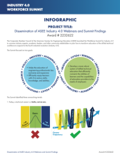 This collection includes three documents and twelve video clips that summarize the results of the Workforce Summit for Industry 4.0 launched by the Corporate Member Council of the American Society for Engineering Education (ASSE). The Workforce Summit for Industry 4.0 brought together "experts,...
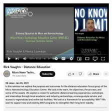 This webinar explores the purpose and outcomes of the Micro Nano Technology Education Center's (MNT-EC) Distance Education Focus Group (DEFG). This focus group "fosters collaboration in Micro and Nanotechnologies through high-quality, authentic learning opportunities that are accessible to students...
|
| ← PreviousNext → |