Browse Resources
Instructional Material -- Lesson/Lesson Plan
Resources |
|---|
 Learning Unit Description:
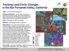
The Integrated Geospatial Education and Technology Training Project (iGETT) presents a series of Learning Units (LU) designed to incorporate federal land remote sensing data into Geographic Information System (GIS) instruction. The Tracking Land Cover Changes in the San...
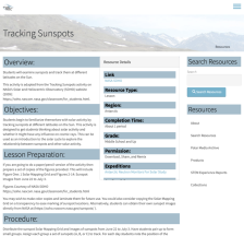 This lesson plan, adapted from NASA's Solar and Heliocentric Observatory website, teaches students how to examine and track sunspots at different latitudes on the sun. This activity "can be used as an introduction to the solar cycle to explore the relationship between sunspots and other solar...
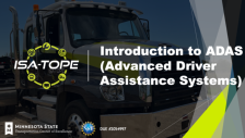 This resource, provided by Dakota County Technical College, includes modules for advanced driver assistance systems (ADAS) technology related to the ISA-TOPE Truck. The modules cover the operations, maintenance, and repair of vehicles equipped with autonomous technology. Four modules are included...
 This activity from the Florida Advanced Technological Education (FLATE) Center is targeted towards middle school students and asks them to examine the relationship between science and technology. The example of medical manufacturing is used to demonstrate this concept. The lesson should require two...
 Learning Unit Description:
Integrated Geospatial Education and Technology Training (iGETT) presents a series of Learning Units (LU) designed to incorporate federal land remote sensing data into Geographic Information Systems (GIS) instruction. This LU "... explores urban heat islands (UHIs), a...
 Exercise Description:
This exercise, created by the Integrated Geospatial Education and Technology Training Project (iGETT) asks students to develop a model to examine the relationship between land use and sediment loading. Data from the Chesapeake Bay region will be utilized. Remote sensing...
 Learning Unit Description:
Integrated Geospatial Education and Technology Training (iGETT) presents a series of Learning Units (LU) designed to incorporate federal land remote sensing data into Geographic Information Systems (GIS) instruction. This LU focuses on what likely caused the crisis in...
 Learning Unit Description:
The Integrated Geospatial Education and Technology Training Project (iGETT) presents a series of Learning Units (LU) designed to incorporate federal land remote sensing data into Geographic Information System (GIS) instruction. The Using Soil Productivity to Assess...
 This lab activity from the Biotechnology Alliance for Suncoast Biology Educators (BASBE) demonstrates the principles of spectrophotometry. It also allows students to develop a testable hypothesis about the chlorophyll concentration in different olive oil solutions. The lesson includes background...
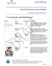 Vehicle Electrification Systems Standards Curriculum Description:
The Vehicle Electrification Systems Standards curriculum is provided by the Northwest Engineering and Vehicle Exchange (NEVTEX) and was developed by Central Oregon Community College (COCC) and Rio Hondo College (RHC). COCC and RHC...
|
| ← PreviousNext → |