Browse Resources
Instructional Material -- Lesson/Lesson Plan
Resources |
|---|
 This scenario-based instructional activity card, from the ATE 2.0: Preparing Technicians for the Future of Work project, was created to support the implementation of the Cross-Disciplinary STEM CORE Framework. This framework has the following three skill areas: Data Knowledge and Analysis, Advanced...
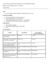 This lesson, provided by the Contextualize to Learn project at the University of Wisconsin-Madison, has students work in groups to represent decimal and mixed number multiplication as area models using base-10 blocks and/or grid paper. The expected total time for the lesson is 65 to 90 minutes. The ...
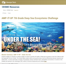 This resource, published by Georgia Tech Research Institute, features an ecology and data visualization activity designed for seventh graders. In this activity, students color-code and quantify data from images of coral to evaluate the health of coral impacted by the Deepwater Horizon Oil Spill. The...
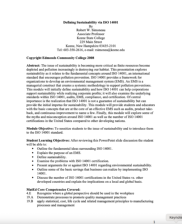 This four-page instructor guide from Edmonds Community College provides a lesson plan introducing to ISO 14001, an international standard encouraging sustainable product design. This lesson plan explores concepts that form the framework of ISO 14001 and how this standard impacts sustainability in...
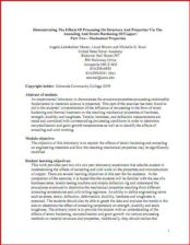 This module will demonstrate "the structure-properties-processing relationship fundamental to materials science." The objective of the lesson is to "explain the effects of strain hardening and annealing on engineering materials and how the resulting mechanical properties may be significantly...
 This module will demonstrate "the structure-properties-processing relationship fundamental to materials science." Students will gain a further understanding of the affects of annealing as well as the effects of cold work on the properties and microstructure of copper. This is part one of a two-part...
 Learning Unit Description:
The Integrated Geospatial Education and Technology Training Project (iGETT) presents a series of Learning Units (LU) designed to incorporate federal land remote sensing data into Geographic Information Systems (GIS) instruction. The Detecting Gypsy Moth Defoliation in...
 Learning Unit Description:
The Integrated Geospatial Education and Technology Training Project (iGETT) presents a series of Learning Units (LU) designed to incorporate federal land remote sensing data into Geographic Information System (GIS) instruction. The Determining Ecoroof Locations to Improve...
 Learning Unit Description:
The Integrated Geospatial Education and Technology Training Project (iGETT) presents a series of Learning Units (LU) designed to incorporate federal land remote sensing data into Geographic Information System (GIS) instruction. The Determining Greenway Potential in...
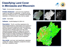 Learning Unit Description:
The Integrated Geospatial Education and Technology Training (iGETT) presents a series of Learning Units (LU) designed to incorporate federal land remote sensing data into Geographic Information Systems (GIS) instruction. The Classifying Land Cover in Minnesota and...
|
| ← PreviousNext → |