Browse Resources
Instructional Material -- Tutorial
Resources |
|---|
 This tutorial, developed by the Canada Centre for Mapping and Earth Observation, discusses remote sensing technology and its applications. The module is intended as an overview at a senior high school or early university level, and touches on physics, environmental sciences, mathematics, computer...
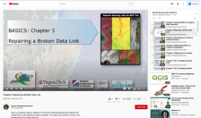 This video, provided by Virginia Geospatial Extension, is part of a series of 28 tutorial videos on remote sensing with ArcGIS Pro. This tutorial "uses ArcGIS Pro version 2.2 to illustrate how to fix a broken data link." This video runs 03:49 minutes in length. The other videos in the series are...
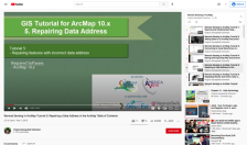 This tutorial, provided by Virginia Geospatial Extension, is part of a series of 30 videos that cover remotely sensed data in ArcMap 10.x versions. This video demonstrates repairing features with an incorrect data address. This video runs 00:45 seconds in length. The other videos in the series are...
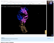 This video, provided by Digital World Biology, is from a series of tutorial videos for iCn3D, a web-based three-dimensional visualization and structural analysis platform for molecular structures. During the video, presenter Sandra Porter discusses using iCn3D to predict whether an antibody will be...
 This tutorial, provided by Virginia Geospatial Extension, is part of a series of 30 videos that cover remotely sensed data in ArcMap 10.x versions. This tutorial demonstrates saving and exporting map documents in ArcGIS. This video runs 00:53 seconds in length. The other videos in the series are...
 This video, provided by Virginia Geospatial Extension, is part of a series of 28 tutorial videos on remote sensing with ArcGIS Pro. This tutorial "uses ArcGIS Pro version 2.2 to illustrate saving ArcGIS Pro maps in forms that can be used in non-GIS platforms." This video runs 03:46 minutes in...
 This PowerPoint tutorial is provided by Hartnell College and covers scientific literature. In this tutorial, students will learn what peer-reviewed scientific literature is, the components of a peer-reviewed research paper, and how to cite a research paper. The tutorial includes an introduction and...
 This video, provided by Virginia Geospatial Extension, is part of a series of 22 tutorial videos on working with Lidar using ArcGIS Pro. This tutorial demonstrates "work[ing] with the two types of templates that can be used with lidar data: Map Template (2-D) and Local Scene Template (3-D)." This...
 This video, provided by Digital World Biology, is from the 2022 Antibody Engineering Hackathon, an event where teams collaborated to develop Course-based Undergraduate Research projects (CURES) for students studying biotechnology. In this video, Sandra Porter, president of Digital World Biology,...
 This video, provided by Virginia Geospatial Extension, is part of a series of 28 tutorial videos on remote sensing with ArcGIS Pro. This tutorial "uses ArcGIS Pro version 2.3 to illustrate spatial enhancement of Landsat 8 imagery including dynamic tools as well as spatial analyst tools, and...
|
| ← PreviousNext → |