Browse Resources
Resources |
|---|
This video, made available by the Northeast Advanced Technological Education Center (NEATEC), is part of the NEATEC Digital Electronics Series from Professor Roger Young. This video describes digital arithmetic and runs 56:49 minutes in length.
This video, made available by the Northeast Advanced Technological Education Center (NEATEC), is part of the NEATEC Digital Electronics Series from Professor Roger Young. This video describes digital systems and runs 1:08:52 minutes in length.
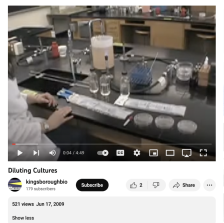
This video from CUNY Kingsborough Community College describes diluting bacterial cultures. The brief demonstration is described step by step and would be easy to replicate in a laboratory setting. Running time for the video is 4:50.
This YouTube channel from Directions Media includes educational videos related to geospatial technology. Directions Media is the leading source of information, news and commentary in the fields of geospatial and location-based technologies. They keep readers informed with news and technology issues...
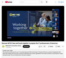
This video from the National Information Technology Innovation Center (NITC) provides an overview of NITC and its services. During the video, presenters go into detail on NITC products, including the IT Innovation Network (ITIN), a community for faculty sharing, learning, and problem-solving, and...
This video, published by InnovATEBIO, provides a discussion between educators on credentialing and biotechnology education. Topics explored include the Biotechnician Assistant Credentialing Exam (BACE), Covid-19, biotechnology programs, and more. The video recording runs 18:41 minutes in length.
This tutorial, provided by Virginia Geospatial Extension, is part of a series of 30 videos that cover remotely sensed data in ArcMap 10.x versions. This video covers displaying Landsat imagery in ArcMap, Setting processing workplaces, and the Image Analysis Window. This video runs 02:53 minutes in...
This video, provided by Virginia Geospatial Extension, is part of a series of 28 tutorial videos on remote sensing with ArcGIS Pro. This tutorial "uses ArcGIS Pro version 2.3 to illustrate how to display different bands of a Landsat scene..." The band's properties are examined, including viewing and...
This tutorial, provided by Virginia Geospatial Extension, is part of a series of 30 videos that cover remotely sensed data in ArcMap 10.x versions. This video demonstrates modifying symbology for vector and raster features in ArcMap. This video runs 01:48 minutes in length. The other videos in the...
This video, provided by Virginia Geospatial Extension, is part of a series of 28 tutorial videos on remote sensing with ArcGIS Pro. This tutorial demonstrates how to display raster data in ArcGIS Pro version 2.2. This video runs 05:12 minutes in length. The other videos in the series are available...
|
| ← PreviousNext → |
